概述
Use these walking maps to help you get moving when at one of our UCSF campuses.
Take a stroll
We’ve created walking maps that are wellness champion tested and approved walking routes around some of our UCSF campuses. These routes can be used for:
- Walking meetings
- Walking 1:1s
- Taking a solo walk break
- Taking a lunchtime stroll
- Group or team walks
Want to share a walking route for your UCSF campus that you don’t see here? Have a photo of you or your and your team using a walking route? Email us at [email protected].
Mission Bay
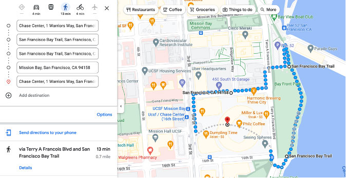
Approx. 13 mins. 0.7 miles: Chase Center > SF Bay Trail > Pier 52 > Chase Center
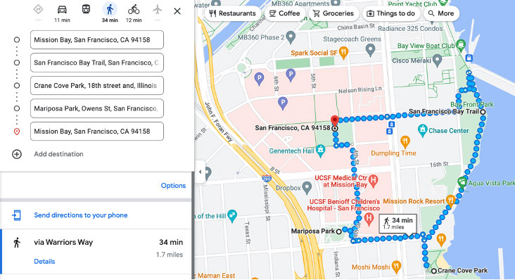
Approx. 34 mins. 1.7 miles: Koret Quad > Crane Cove Park > Mariposa Park > Koret Quad
Parnassus
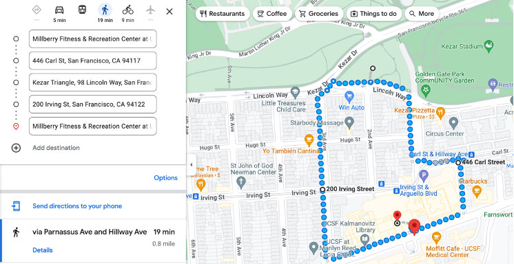
Approx. 19 mins. 0.8 miles: Millberry Union > Golden Gate Park Community Garden/Kezar Triangle > Millberry Union
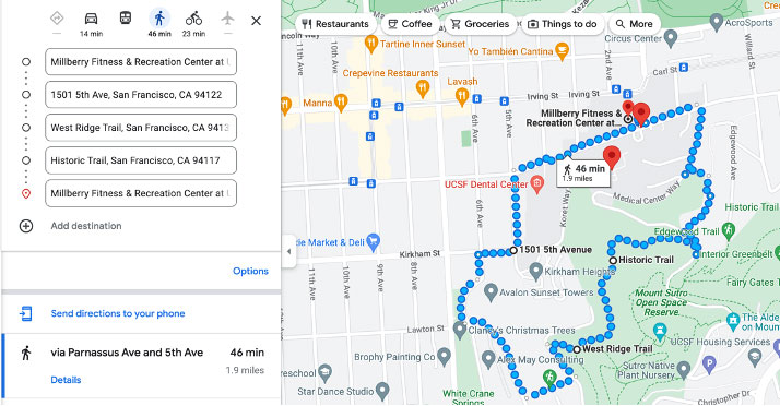
Approx. 46 mins. 1.9 miles: Millberry Union > Garden for the Environment > Oakhurst Lane > Mount Sutro > Millberry Union
Mount Zion
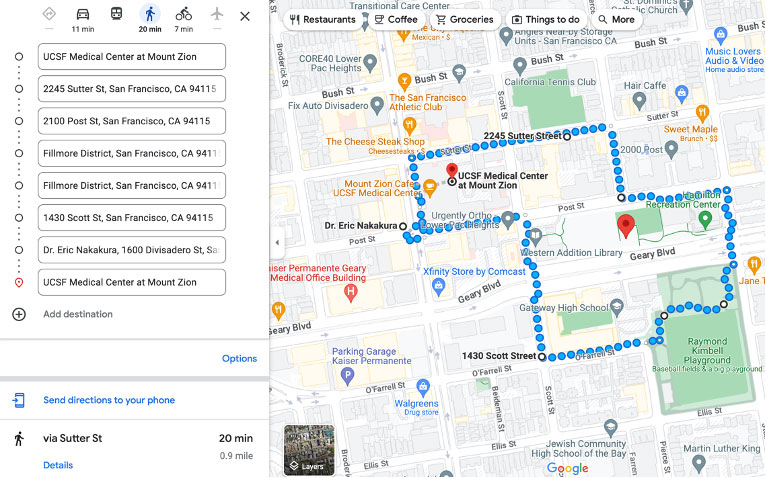
Approx. 20 mins. 0.9 miles: Mount Zion Medical Center > Hamilton Tennis Courts > Turf Field & Park > Mount Zion Medical Center
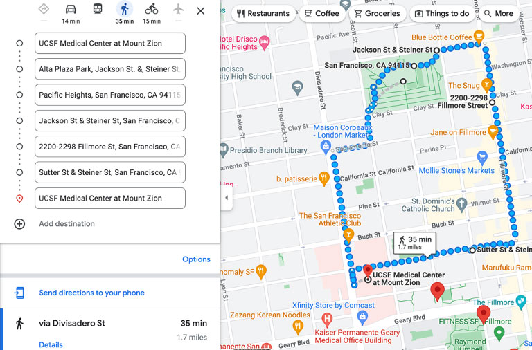
Approx. 35 mins. 1.7 miles: Mount Zion Medical Center > Alta Plaza Park > Fillmore Street > Mount Zion Medical Center
Zuckerberg SF General
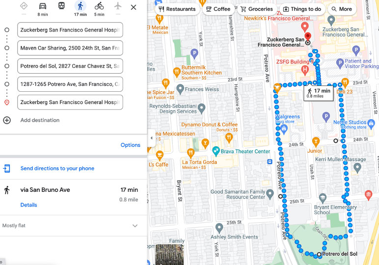
Approx. 17 mins. 0.8 miles: ZSFG > Potrero del Sol > ZSFG
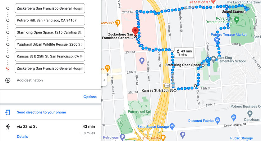
Approx. 43 mins. 1.8 miles: ZSFG > Potrero Hill > Starr King Open Space > Urban Wildlife Rescue > ZSFG
Oakland
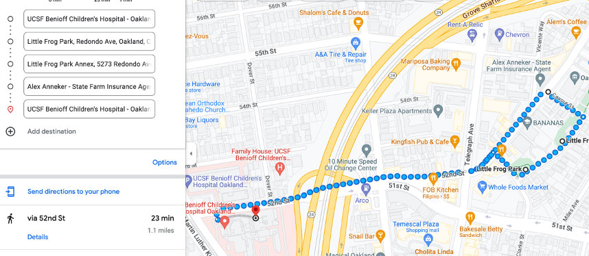
Approx. 23 mins. 1.1 miles: BCH > Little Frog Park > BCH
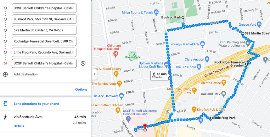
Approx. 46 mins. 2.3 miles: BCH > Bushrod Park > Rockridge-Temescal Greenbelt > Little Frog Park > BCH
Fresno
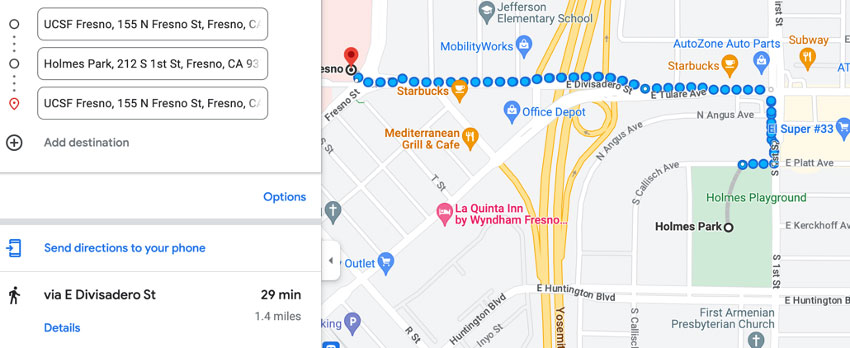
Approx. 29 mins. 1.4 miles: UCSF Fresno > Holmes Park > UCSF Fresno
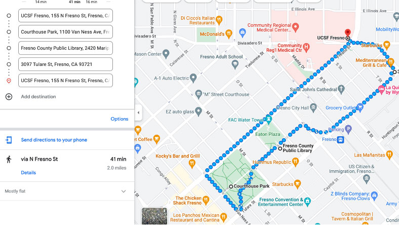
Approx. 34 mins. 1.7 miles: Koret Quad > Crane Cove Park > Mariposa Park > Koret Quad
Walnut Creek
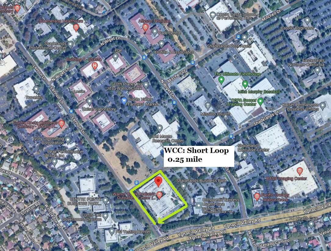
Approx. 10 min .25 Miles > UCSF Benioff Children's Hospital Walnut Creek > Shadelands Dr > Shadelands Business Park.
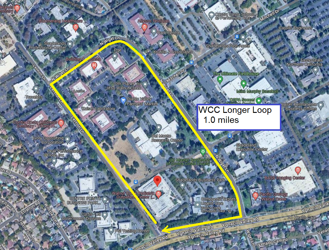
Approx. 29 min 1.3 Miles > UCSF Benioff Children's Hospital Walnut Creek > Wiget Lane > Ygnacio Valley Road.

